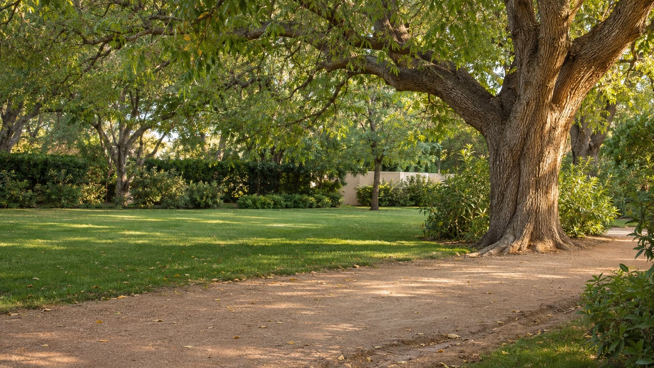
Parks crews keep putting fresh decomposed granite on the Murphy Bridle Path. So why does it keep rutting, pooling, and washing away after rain?
The City of Phoenix answered that question this fall, in an engineering scope attached to a grant request that City Council approved on October 7, 2026. The answer is partly about maintenance and mostly about plumbing. The 2.5-mile stretch of Central Avenue from Bethany Home Road to the Arizona Canal has no storm drain, and the reason it has none is also the reason the path looks the way it does. Residents wanted the historic streetscape protected, and the city listened. The ruts are part of that tradeoff.
The Drain That Was Designed and Never Built
A city document lays out how the system works. The scope of services in the October 7 Council agenda describes Central Avenue in this stretch as a crowned asphalt road with no curb, no gutter, no catch basins, and no storm drain infrastructure. Rain sheets off the road into roadside swales. Driveways without culverts usually block those swales, so the water ponds and erodes both the swale and the path beside it.
A recent city site visit found ponded water and eroded areas along the east edge of Central and on both sides of the path. It also found swales, ditches, driveway and path culverts, and cross-street catch basins partly filled with sediment, with no positive drainage grade to carry water away.
The city did once draw up a fix. Project ST-846071 called for a trunkline down the middle of Central Avenue, in pipe 36 to 48 inches wide, from Griswold Road south to Bethany Home Road. There it would tie into an existing line that was sized to take the extra flow. The scope explains what happened next:
"The storm drain trunkline, laterals, and catch basins proposed along Central Avenue's roadside swale were never built due to public concern over impacts to the historic Central Avenue streetscape."
Without that pipe, every heavy rain drains across the dirt. The city's grant application describes the path as about six feet wide, made of dirt with a scattered overlay of decomposed granite. It says maintenance has meant laying down more granite from time to time and that "the path continues to be threatened by erosion." The same application says the path "has experienced significant erosion despite Parks attempts at maintenance" over the last 20 years.
Fresh granite on a path with nowhere for water to go only gets washed away again.
Why Any Fix Has to Keep the Streetscape Intact
The path is protected because it is part of a designed rural landscape that predates most of the houses along it. City planning history says William J. Murphy platted Orangewood in 1895 as large-lot estates along Central Avenue. Olive and ash trees lined both sides of the avenue, and citrus grew on the interior lots. The Central Arizona Driving Association arranged for Central to be deeded as a "driving street" for horse-drawn buggies. A separate path on the east side was reserved for horses and riders.
The path's name and its length came later:
- 1895: Murphy plats Orangewood, with Central Avenue as its main road.
- 1948: The Arizona Horse Lovers Club officially names the horse path on the east side of Central "Murphy's Maricopa Bridle Path."
- 1951: The Maricopa County Board of Supervisors extends the path from the Arizona Canal south to Camelback Road. Later road widening moved its southern end back to Bethany Home Road.
- 2005: The North Central Avenue Streetscape Historic District is listed in the National Register of Historic Places.
The National Register nomination gives the district a period of significance of 1895 to 1951. It treats the Central Avenue right-of-way as one composition made up of the lateral ditch, the bridle path, the narrow roadway, the wasteway, and the tree rows. The city's application counts four rows of trees as contributing sites. It lists four contributing structures: an irrigation ditch, remnants of a wasteway ditch, a narrow arterial street, and the bridle path.
So a fix can't simply bury pipe and pour curb. The narrow unpaved edges and the open ditches are part of what the district protects. Under the scope, the project "shall be designed to preserve the Bridle Trail and cause as little impact as possible" in order to meet the Secretary of the Interior's Standards for Rehabilitation. The application also commits the study to the National Park Service's Preservation Brief 36 on protecting cultural landscapes.
What the $195,000 Study Covers
The approval moved through two votes. The Phoenix Historic Preservation Commission recommended it 7 to 0 on August 17, 2026. City Council then adopted Item 74, Ordinance S-53238, on October 7, according to the meeting results.
Council's vote authorized the city to apply for a $20,000 Arizona State Historic Preservation Office Certified Local Government pass-through grant. That money would go toward a study estimated at $195,000. The grant program requires at least a 40 percent local match, and the city plans to cover 90 percent, or $175,000, with the grant paying the rest if awarded. In practice, Phoenix is paying for most of this work itself.
The application lists six planning activities for a hired consultant:
- Hold two public outreach meetings
- Research all available planning and design documents for the path
- Set design criteria
- Prepare an environmental and cultural resource overview
- Develop design alternatives
- Evaluate those alternatives and produce a report with draft 15% plans
The engineering scope lists what the consultant will examine on the ground: path surfacing and side slopes, curbed and uncurbed road edges, driveway crossings, culverts, headwalls, swales and ditches, mailbox locations, utilities, landscaping, and retaining and screen walls. The consultant will also develop preliminary drainage concepts for up to three path alternatives. Driveways and mailboxes made that list because, as the grant application notes, driveways, some of them paved, cross the path to reach homes.
A draft 15% plan is an early design, not a construction drawing. The application's schedule runs the project through June 30, 2027, so the result will be a set of options rather than new path surface.
Your First Chance to Weigh In Is Early 2027
The application's proposed schedule puts both public meetings in January and February 2027. The city describes those meetings as a chance to explain to path users why the path matters to Phoenix history. In the application's words, "not all might understand the significance of this resource." The application names the people who use it now: "bikers, walkers, joggers and occasionally a horseback rider."
The North Central Phoenix Homeowners Association, a volunteer neighborhood group, was working on the path well before the city's vote. In a notice in the September 2025 issue of North Central News, the association wrote that cars or large trucks driving or parking on the path make it deteriorate faster, and that "deep ruts create safety hazards for pedestrians and bicyclists." The same notice reminded residents on the east side of Central Avenue that there is "NO PARKING between your property line and the street at any time." That reminder comes from the association, so check your own property's situation with the city or a qualified professional. This post is general information, not legal advice.
The association's Tree Committee also worked with the city in 2024 to replant 56 Arizona ash trees along the path. That keeps one of the district's contributing tree rows in place while the path's drainage gets studied. In the same notice, the association asked for volunteers to serve on a committee "to assess, evaluate, and determine preservation strategies for this beloved historical path." It covers 7th Street to 7th Avenue, Missouri Avenue to Northern Avenue, and posts updates at ncpha.org.
That leaves two months before the first planned meeting. The meetings will cover how much of the old streetscape stays as it is so that the path can drain.
At The Caniglia Group, we've followed how the Central Avenue streetscape shapes life along the Murphy Bridle Path for decades. If you live near the path, own a home that fronts it, or are wondering how the study could affect a driveway crossing, we're glad to talk it through. Schedule a free consultation.